The Times of India 22.02.2013
No escaping property tax now
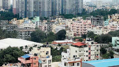
RAJKOT: It won’t be easy to evade property tax
now. Rajkot will be the first city where every property – commercial,
residential and institutional – will have a unique property
identification number.
Using the Geographic Information System
(GIS), a map-based information arrangement, Rajkot Municipal
Corporation (RMC) has completed a comprehensive survey and charted all
buildings in the city.
“All information, including photographs
of building units are now available. Details regarding property which
have not been assessed for property tax and buildings that have
undergone a change of designated use, are also readily available,” said
municipal commissioner Ajay Bhadoo.
“The GIS-based survey has
been completed and we are now doing a field survey of all properties in
the city, which will be completed in six months. Once the final
validation survey is complete, every property in the city will be given a
unique number. The Property Identification Number (PID) will have the
corresponding house number, detailed address and owner’s name, details
like electricity and water connection numbers, as well as data like
built-up and carpet area, number of floors, usage and year of
construction. A photograph would be linked with the all of this data,
along with tax payment and town planning-related history of the
property.
Bhadoo said this is perhaps the most comprehensive
GIS database created by any city in the country. “It not only covers
properties, but also has data related to trees, temporary structures,
and municipal as well as other service utilities,” Bhadoo said.
Interestingly, the GIS-based survey helped the civic body mop up
property tax revenue as well. RMC officials said that by using this
database, property tax collection increased from Rs 120 crore per annum
to Rs 160 crore in last two years.
“There will be huge gains in
property tax collection once we complete the survey,” said an RMC
official. The consultancy work for this GIS survey was given to Science
and Technology Park, an autonomous institute of the University of Pune. It is promoted by the department of science and technology (DST) of the Government of India.
Data will help disaster management too
The GIS-based survey has not only mapped buildings, but also several
other crucial details that could prove handy in the event of a disaster.
The survey has collated data of the length and width of roads,
footpaths, drainage network, telephone poles, streetlights, manholes,
valve chambers and water supply network among other utilities. “This
database will help immensely in the event of a natural disaster, as
details regarding schools, fire brigade stations, open grounds and
government organizations in the city will be instantly available,” said
an RMC official.